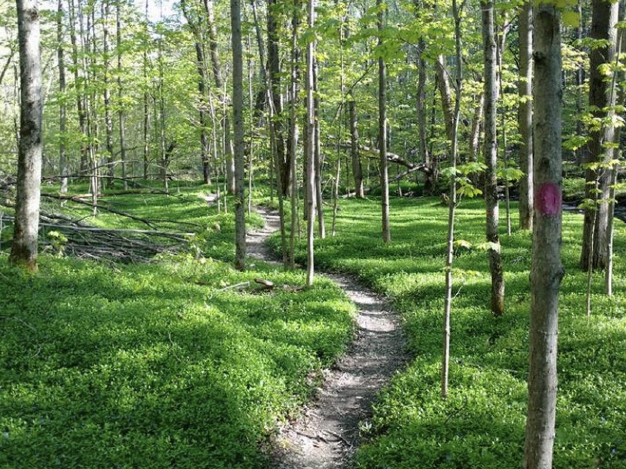
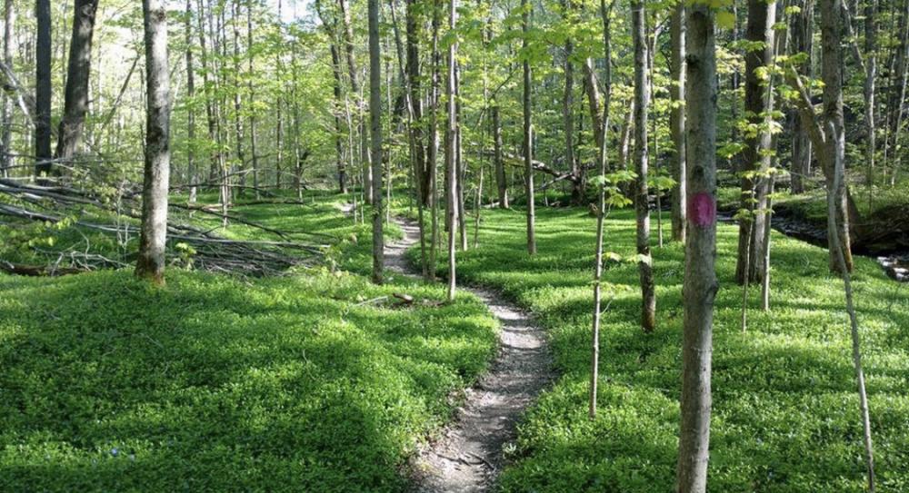
Residents and visitors interested in hiking, biking, riding, and/or rowing Chautauqua County’s 250+ miles of trails have new resources available to help them plan their trip with the new interactive trails map and mobile map application. More details available at CHQTrails.org
CHAUTAUQUA COUNTY, NY – There’s a new resource available for people who want to hike, ride, or even paddle hundreds of miles of trails in Chautauqua County.
The Chautauqua County Partnership for Economic Growth (CCPEG), in collaboration with Chautauqua County Government and the Friends of the Chautauqua County Greenways (FCCG) group, is pleased to announce the release of the new Chautauqua County Interactive Trails Map and accompanying mobile application. The new interactive map, along with links to individual maps and also a mobile application, can all be found at CHQTrails.org.
According to Jacob Bodway, CCPEG Trail Coordinator, the need for an interactive trail map covering all of Chautauqua County is the result of an increased interest in the various trails found across the area, especially since the COVID-19 pandemic.
“As we witnessed more trail users exploring our trails, many for the first time, we also heard a renewed interest in a trail map that would provide information for trail users of varied experience and ability,” Bodway said. “I think that the new countywide trail map does that and more.”
This interactive online map allows trail users to explore the hundreds of miles of trails throughout the county. They can select and view trails that fall into specific activities, like hiking, biking, horseback riding, cross country skiing, and kayaking. Users will also be able to select trails based on land-owner, like those found in state forested land, or those associated with a specific organization or community. It also features images of trail heads and provides information on trail surfaces, trail length, and parking.
“It’s the perfect ‘one-stop-shop’ for trail users who want to spend a weekend or longer exploring the trails in the county,” Bodway explained. “The map really is a game changer and will give users all of the information that they need to make an itinerary for their next outdoor adventure in Chautauqua County.”
The mobile application can be downloaded from Avenza, the top-rated app used for hiking and biking, even in the most remote areas of the world. Using GPS technology, Avenza is useful for when trail users are on the trail and want to see their location in real time, regardless of cell reception. Several trail maps have been added to Avenza – including Boutwell Hill, Harris Hill, and North Harmony State Forests; Long Point State Park; Audubon Community Nature Center; and Cassadaga Lakes – along with others. These county maps will also be available on other third-party apps, such as Trailforks, All Trails, and MTB Project. PDF versions of individual trail maps can also be viewed, downloaded and also printed from the website for trail users who may not have the ability to use the mobile app.
Mark Geise, Deputy County Executive for Economic Development and CCIDA CEO, emphasized that the maps and mobile application all align to the County’s efforts to make Chautauqua County known as a mecca for outdoor recreation and active living.
“We have such incredible outdoor recreation assets, including more than 600 miles of recreational trails which we are actively working to improve,” said Geise. “These maps not only help our county market itself as a tourism destination for outdoor enthusiasts, but help our own residents discover all we have to offer.”
Funding for the trail project comes from generous support provided by The Ralph C. Sheldon Foundation, the Chautauqua Region Community Foundation, and the Northern Chautauqua Community Foundation. CCPEG selected Barton & Loguidice and Adirondack Research to oversee the project, following an RFP process that saw 15 proposals come forward. After a year of collaboration, the interactive trail map and mobile application were unveiled at the most recent FCCG public meeting, held at the SUNY Fredonia College Lodge on June 12, 2024.
“The countywide trails map is the culmination of what happens when trail user groups work together to achieve a common goal,” noted Bodway. “I couldn’t be more proud of the teamwork and cooperation that went into creating the countywide trail map, and I’m excited to see where we go from here.”
Plans are underway to provide a limited number of print copies of individual trail maps, and to also to remind trail users about the existence of the interactive map and mobile app with signage along the trails, in addition to other marketing efforts across the region. Meanwhile, the interactive map and additional details on where to find and install the mobile map application from Avenza can be found online at CHQTrails.org.
About CCPEG - The Chautauqua County Partnership for Economic Growth (CCPEG) serves as the main convener of economic development partners and resources to advance key projects that achieve economic prosperity in Chautauqua County. It also serves as the catalyst and broker of resources for advancing economic prosperity efforts and is the central coordinating entity for the formation, retention, development, and attraction of quality jobs and advancements to the quality of life. It is an initiative of the Chautauqua Region Economic Development Corporation (CREDC). For more information visit CHQPartnership.org.
About FCCG - Friends of the Chautauqua County Greenways (FCCG) is an organization housed under the Chautauqua County Partnership for Economic Growth and whose aim is to collaborate and build on existing private/public partnerships to realize the primary objectives outlined in Chautauqua County’s 2012 Greenway Plan and updated in the 2022 Chautauqua County Greenways Group Action Plan. FCCG's mission is to create a new enthusiasm for active living and healthy lifestyles for all people and of all backgrounds; promote accessible, safe, and sustainable recreation opportunities; sustainably conserve the ecological health, water quality, and scenic beauty of our region; improve our quality of life within Chautauqua County; act as a catalyst for economic development related to outdoor living, trail development, and trail maintenance in NYSDEC state forests, Chautauqua County parks, and waterways; and establish Chautauqua County as a destination center for outdoor adventure.